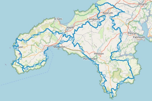
The West Kernow Way is a 236km off-road bikepacking route with 4,000m elevation connecting many of Cornwall’s landmarks and trails, devised by Cycling UK and historian / cycling journalist Guy Kesteven.
Starting in Penzance, the route takes you on a figure-of-eight loop around the western peninsula of Cornwall. It includes diversions to the Minack Theatre, Land’s End and The Lizard Point, with other points of interest including Cape Cornwall, The Loe and the mining trails around Redruth, before ending in Marazion in front of St Michael’s Mount.
Having completed the King Alfred’s Way last year, I’ve caught the bikepacking bug hard. Cycling UK announced the route in Autumn 2021 and seeing as September worked well for last year’s trip, I aimed to complete this route at a similar time.
I was originally going to ride the West Kernow Way with my friends, Rob and Charlie, who I rode the King Alfred’s Way with last year. However, that dwindled down to just myself and Rob nearer the start.
Having learnt last year that 80/90-mile days are rather difficult to adhere to in the daylight, we decided to ride the route in three days so we could also enjoy Cornwall’s sights.
Day 1 would see us ride 60 miles from Penzane to Porthleven, with stops to explore both The Minack Theatre and Land’s End.
Day 2 would be a shorter but equally hilly 45-mile day from Porthleven to Falmouth. Falmouth isn’t on the official route (it’s a five-mile diversion) but B&B’s can be few and far between in Cornwall and that was where we happened to find one.
After a five-mile ride to pick the route back up in Longdowns, Day 3 was to be a 50-mile jaunt to the route’s end.
The Bike

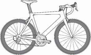
Cycling UK recommends the route as suitable for both gravel and mountain bikes. My Niner RLT 9 RDO gravel bike with a Campagnolo Ekar groupset made for an excellent companion on the King Alfred’s Way last year and I had planned to ride it again for this route.
However, I was commissioned to review a Berria Belador Allroad for BikeRadar. The Belador Allroad is the first gravel bike from the Spanish brand, and is significantly racier than my Niner. It notably features a pivot at the seatstay junction called the ‘Active Flex Concept’ that delivers 26mm of movement. The bike features a SRAM Rival eTap AXS XPLR electronic groupset, carbon Zipp 303S wheels and a fully integrated front end.
Although it’s a gravel race bike, Berria says it’s suitable for bikepacking, so what better way to test that claim?
I’d ridden around 400km on the Berria prior to the West Kernow Way and had a good idea of how it handled. I was a little apprehensive because my initial impressions were that it wasn’t the most comfortable, nor particularly composed over seriously technical terrain.
As for how it performed, you can read my full review over on BikeRadar.
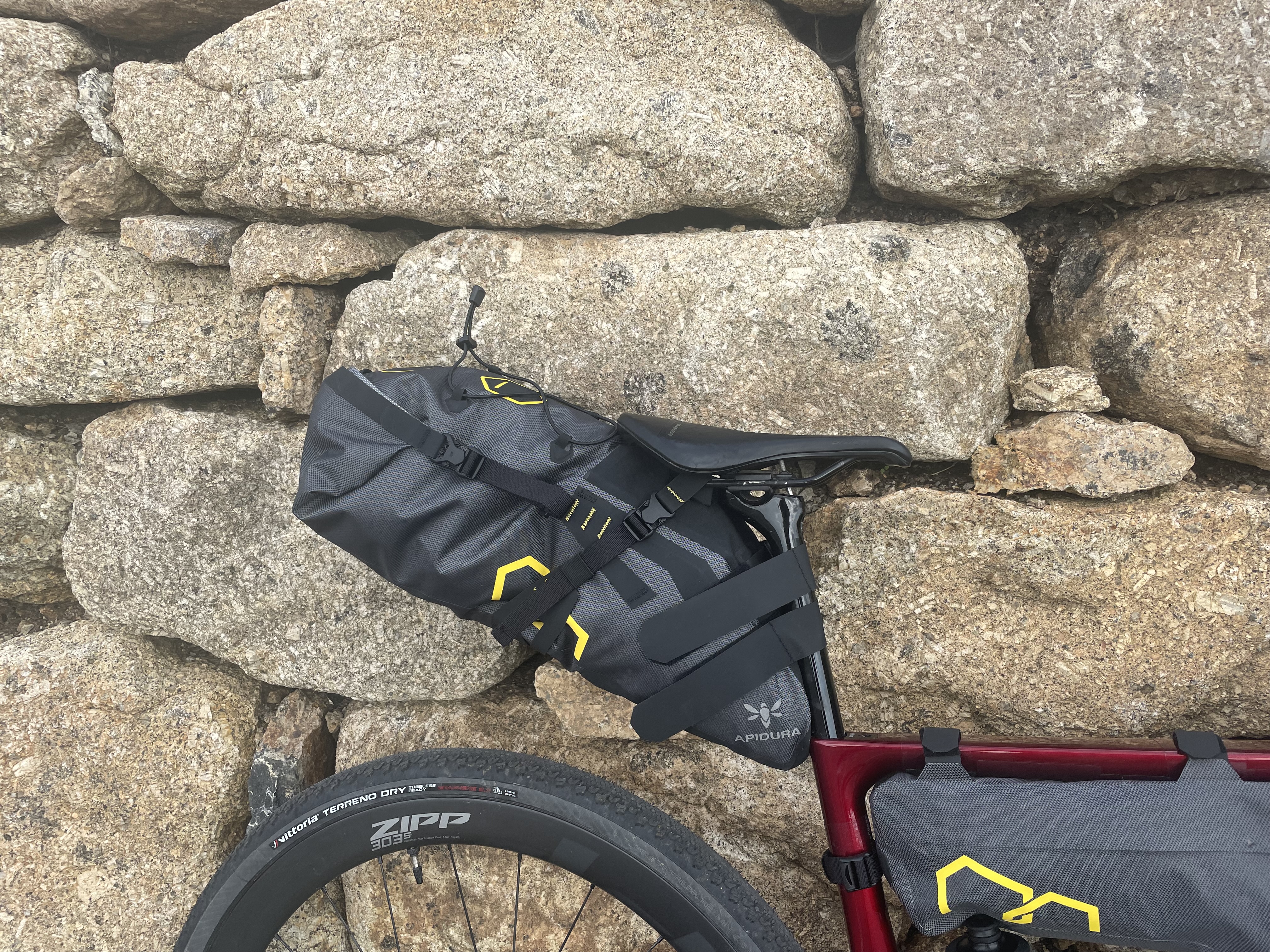
Although I used Miss Grape bikepacking bags last year, Apidura kindly sent me its Expedition bags to test. I used the 9L Expedition Handlebar Pack, 4.5L compact-fit Frame Pack and the 14L Expedition Saddle Pack, which all performed close to faultlessly.
One mistake I made was forgetting my preferred Rapha Explore Powerweave shoes, meaning I had to ride in a pair of Fizik Vento Ferox’s, which I’d tested for BikeRadar and didn’t particularly get on with.
Rob also rode a gravel bike and his happened to be new, too. Earlier in the Summer, he ordered a Reilly Gradient and it arrived a couple of weeks prior to this trip. The Gradient features a titanium frame and offers a significantly more relaxed geometry over the Berria, with a spec including a SRAM Force XPLR eTap AXS electronic groupset with Miche wheels and Continental Terra Trail tyres.
Preparation
I’ve been on good form this year, having moved to Bristol back in April for work. Although I’ve covered roughly the same distances as the last couple of years, what’s boosted my fitness are my 8km work commutes three times a week. It may not seem like a lot but it all adds up.
My tactic for the King Alfred’s Way paid off last year and so I replicated it again this year. I don’t have a problem with riding these distances off-road but it’s a different story when you’re doing this consecutively over multiple days.
For training, I did some long rides over three or four days and started to taper down a couple of weeks prior to the event. I’d also been fortunate to ride a Canyon Endurace in Sardinia back in July, which helped with elevation training.
On the afternoon before our first day, I met Rob at Bristol Temple Meads station and we embarked on the 200 mile journey down to Cornwall. Being a Friday evening, we inevitably got stuck in some grim traffic on the M5 and I had to put the pedal to the metal of my tin can Ford KA to make the hostel we’d booked in Penzance before the check-in closed at 10pm.
We just about made it in time and after getting my bikepacking bags packed for the morning, I attempted to hit the hay. Hostels really aren’t my bag but this was the bargain of the trip at £30. Fortunately, the next two nights would be at B&Bs.
Luckily, the room that could sleep eight wasn’t at full capacity and we just had two others to share the room with. Even still, I didn’t get a particularly good night’s sleep because it was pretty ferociously hot in the room and opening the window didn’t really achieve anything.
Day 1
After a rather hearty breakfast at the hostel (although not as substantial as Rob’s cereal, followed by full English, then toast and pastries!), we got everything packed.
We thought we’d try our luck by seeing if we could leave the car at the hostel for the three days but that plan failed. Luckily, the Sainsbury’s in Penzance was our Plan B and you can park there via the YourParkingSpace app for just over a tenner.
We made the short journey to Sainsbury’s, parked the car and got the bikes ready to go. Between us, we’d taken three pumps – I had a Silca Tattico mini-pump and a larger Lezyne digital mini track pump, whereas Rob had something in between size-wise. We decided that as we were both riding relatively new tyres and Rob had tubeless plugs, should the worst happen, I’d carry the small Silca pump.

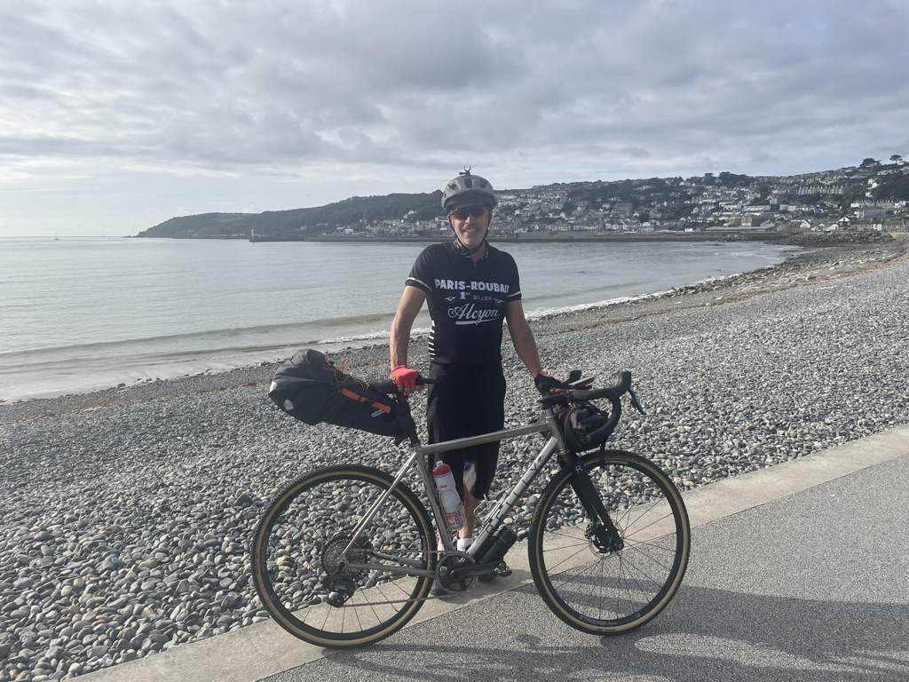
Onto the bike and straightaway, a bus gave me some encouragement as I turned out of the supermarket car park, clearly unhappy that his journey would be inconvenienced by 30 seconds. After about a kilometre, we arrived in the centre of Penzance which is the official start of the route. Rob and I made sure to take a photograph at the start overlooking the picturesque beach.
The route was reasonably flat through Penzance as it straddled the paved coastline and about 5km in just before reaching Mousehole, I noticed Rob only had one bottle on his bike, having left the other in the car. Rather than turn back and retrieve it, Rob decided he’d buy one if we came across a bike shop. Despite Rob’s faux pas, we had roughly the same amount of water because I could only carry two small 500ml bottles, thanks to the wanting bottle cage clearance with the Apidura frame pack.
The hill out of Mousehole was pretty disgusting, although at least it was paved. This was followed by an equally steep and twisty descent into Lamorna.

We’d reached our first off-road section of the day, which was a brief but picturesque climb through the trees up to a road. A reasonably undulating but steady 10km or so followed before we diverted to the Minack Theatre.
We were welcomed by the mesmerising views of Porthcurno beach, one of the top rated beaches in the UK. After a photo opportunity, we explored the spectacular open air theatre perched on the cliffs overlooking the beach. After an explore and brief sit-down to watch part of a rehearsal, we had a quick coffee and then got back on the bikes.
Rob suggested the prospect of lunch at Land’s End but that was only going to be roughly 32km in to a 96km day, so we agreed we’d try and eat at around the half-way mark.
The route to Land’s End was virtually all on the road, bar one muddy trail where the Vittoria Terreno Dry tyres were called to the test on my Berria. It wouldn’t be unexpected to report that grip wasn’t ideal.
We reached the route diversion for Land’s End as we met the A30 and turned onto it. After a kilometre or so of road, the route takes you on The Cornish Way trail, a glorious gravel track with arresting vistas of Sennen Cove – one of the highlights of the trip.

Now at the farthest point of the UK, a brief wander around Land’s End revealed the iconic signpost now required payment if you wanted a photo taken in front of it. There is a kiosk next to the sign where a photographer captures an image of you and can then send you hard copies or a downloadable file – we thought “Screw that!”.
We followed the magnificent Cornish Way back to the A30 and decided we’d try and get a solid couple of hours riding in.
Almost instantly after we set off, Rob’s rear tyre looked on the low side and we stopped to inflate it – this would go on to become a running theme of the trip. Rob was running Continental Terra Trail tyres and had set them up tubeless. Neither of us could find any problems with the tyre or the tubeless valve.
It was largely more of the same in terms of terrain – lumpy road until around 42km. A few minutes before the gravel arrived, I had remarked it was disappointing there had only been a stingy portion so far. I certainly got what I asked for.

We were faced with a viciously steep ascent on loose rock, where it could have been very easy to lose momentum if you picked the wrong line.
This was then followed by an equally loose descent that we had to carefully pick our way down. The surface mellowed for a kilometre or so and we had another fairly rocky climb followed by another technical descent where the SRAM brakes got called into action. Additional spice featured with two walkers walking up the opposite way and whenever you’re trying to negotiate a technical descent where the slightest wrong choice could go wrong, you don’t want to embarrass yourself!

The descent featured stunning views of Cape Cornwall and once we reached the bottom, we had a brief explore and photo opportunity. We then reached a road climb that would lead us to the town of St Just where I passed a cyclist on a carbon framed road bike sans luggage, who wasn’t particularly impressed I’d gone past with bags galore and wide 38mm tyres!
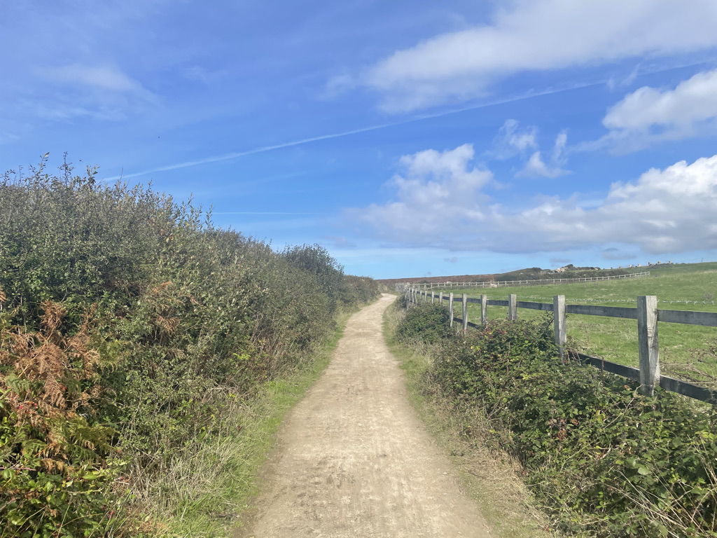
It wasn’t long before we arrived on off-road terrain again as the route hugs the coastline before turning inland at Trewellard. The terrain here was ideal for a gravel bike – a relatively fine surface with some grass and meadowland thrown in.
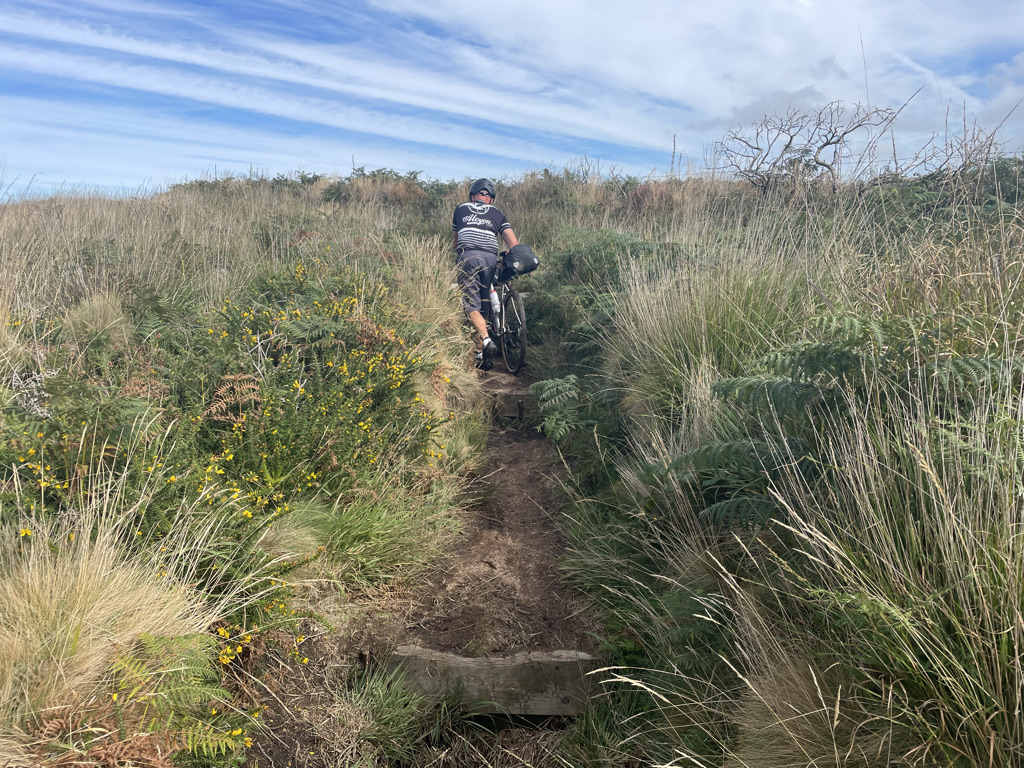
This turned into some seriously technical singletrack with some interesting gates thrown in for good measure. The paths were very narrow with frequent galleys and sharp rocks that could rip your tyres if you rode at the wrong angle. Whilst this section was fun, it was very slow-going and would probably be more suited to a hardtail mountain bike.
At one point, Rob looked like he was going to stack it as he came in rather hot on a brief drop that had a sharp rock next to it which he tried to avoid. Shortly after, I experienced a slow-motion fall where I took the wrong angle on a path and only hurt my pride briefly.
It took us a good hour to ride what was 12km or so, but it just shows the contrast in terrain the West Kernow Way offers – the first 40km on the road may be fairly easy going but then you can get quite literally bogged down in singletrack.
This extended singletrack section finished with a pretty epic but tricky descent that had some metal barriers every 100m or so for good measure! I was feeling both ready for some food and I was getting in quite a desperate state to refill my bottles once we hit the road. There wasn’t much around and it didn’t look like we were going to find civilisation until we’d reach St Erth.
A little later than expected, I struck gold when I spotted a service station on the map slightly off the route once we reached the A30 crossing at Canonstown. We stocked up on water and I had an enormous Cornish pasty and full-sugar Coke, while Rob had a sandwich and we shared some cherry glazed cakes.
Refuelled and refreshed, we picked the route up again which was predominantly small, leaf-stricken roads for a couple of kilometres. We experienced a slight route error where our navigation wanted us to head through someone’s driveway and after a brief moment of research, we worked out there was a trail that circled the property to avoid this.

The route continued to be a mixture of mud-stricken roads and even muddier trails, and the service station stop wasn’t giving me a boost yet. One tough climb was particularly boggy and I’d somehow managed to get a stone in my shoe. I had to perform acrobatics to carefully take my shoe off, extract the stone and put it back on without my foot meeting sloppy mud.
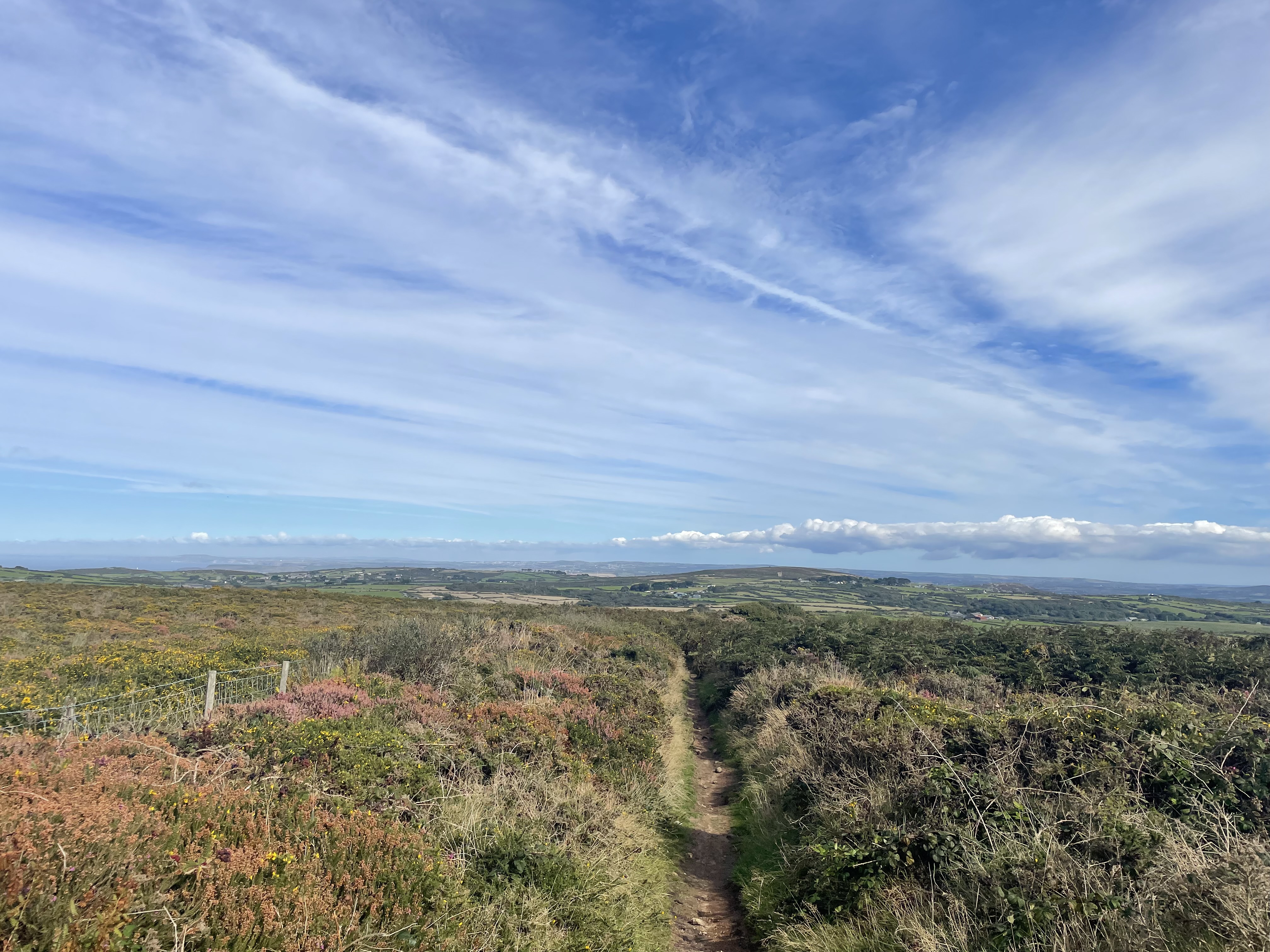
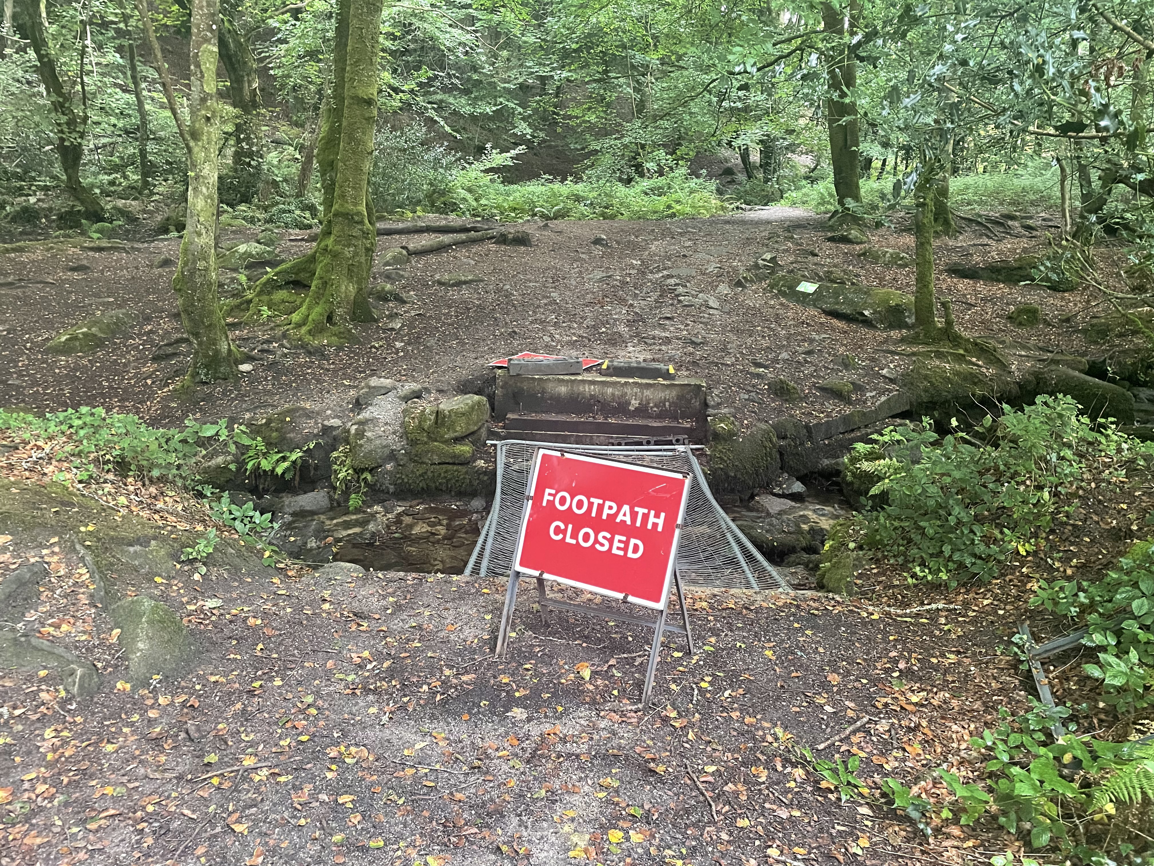
The route continued to be annoyingly undulating and after a pleasant heather-infested section atop a hill, we reached an interesting gate with a sign indicating the trail was to become a footpath. Rob suggested turning back but I stubbornly wanted to continue the route and if it meant a brief walk for a footpath past a farmer’s property, so be it.
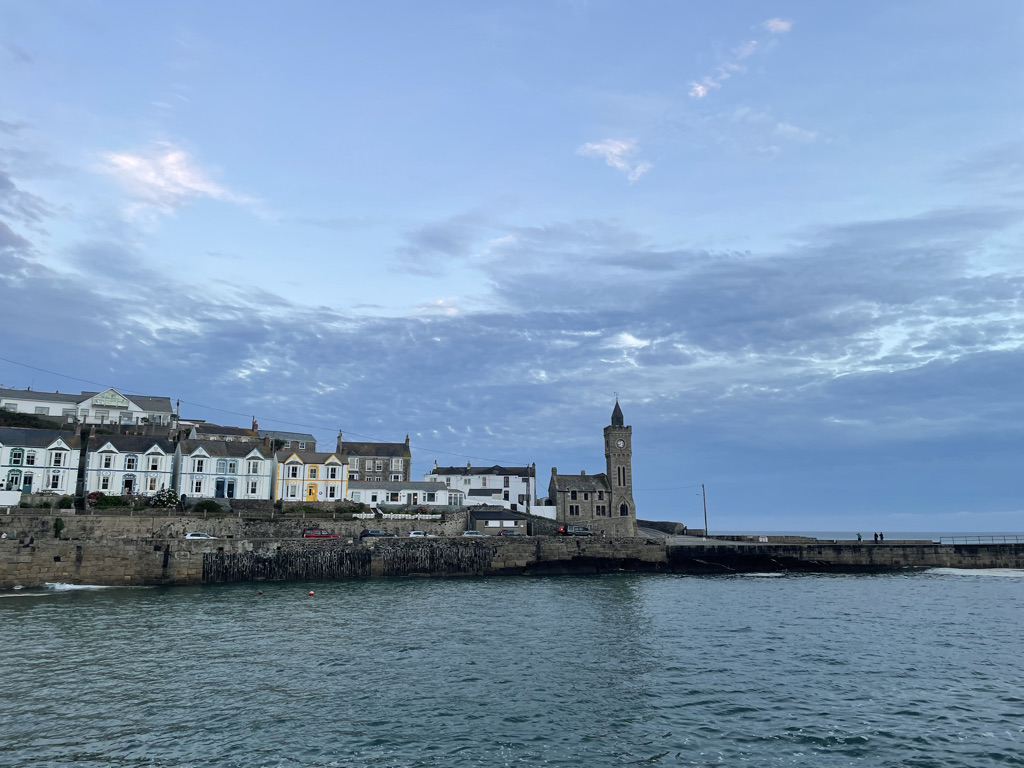
Once we’d walked through, we were greeted by the breathtaking view of Porthleven. The descent into the town was excellent and prolonged, before we then located our sleeping quarters for the night.
Porthleven is an ideal place to split the route because the second half of Day 1’s route was fairly difficult. Performance-wise, I hadn’t had the best of days – the route was a real trudge in places and the service station stop hadn’t really benefited me. 60 miles may not seem a lot but in these conditions, it’s more than enough.
Rob and I had a beer at The Harbour Inn to celebrate our efforts and then ate a disappointingly small and overpriced ‘large’ fish and chips at The Ship Inn – whilst the pub was rammed and had character, I’d recommend heading elsewhere for food.
Total distance: 96.7km
Total elevation: 1,603m
Day 2
After a rejuvenating eight hour’s sleep, Rob and I enjoyed a delicious breakfast at The Harbour Inn and set off just after 10am. Today was to be a shorter 45 miles to Longdowns, followed by five or so miles to our B&B in Falmouth but with equal elevation to yesterday. With yesterday’s 60 miles and 1,600m elevation in the legs, it’d be safe to say the legs didn’t feel particularly fresh. Rain was also forecast until around 1pm, although as we started to get the bikes ready for the day, there was some coastal mist – I decided to stick my waterproof on straightaway.
We headed out via Porthleven’s harbour and after a short climb, we were greeted by our first off-road section of the day. The route overlooks the coastline and after a relatively steep descent, you get a glimpse of The Loe.

The Loe is Cornwall’s largest freshwater lake, separated by the sea via a picturesque beach. After some picture-taking, we diverted off the route to have a further explore and Rob suggested the idea of skipping the beach to avoid unnecessarily ruining the bike’s drivetrains.
The route around The Loe was fabulous, the lake cutting an imposing presence – it’s a slice of heaven for walkers or cyclists who are lucky enough to live in this area. After cycling past the National Trust cafe and reaching the other side of the lake, we discovered the diversion would add more mileage than it was worth, so we decided to head back up again and cross the beach. At this point, it started to rain.

That’s just what we did and after trundling back up the climb to where we made our diversion, we descended down to the beach. The beach wasn’t rideable, so we got off and walked and I took the opportunity to get my ‘money shot’ photo of the Berria for my BikeRadar review.
It really started to rain at this point and Rob donned his waterproof gear. An off-road climb led us to the road, which would take us to Mullion. The road was briefly interrupted by a short yet upsetting, sandy and rutted climb through a golf course.

We took to the trails once again after we passed through the village, and it was more of the same rutted gravel with a beautiful heather-infested backdrop. There was one particularly rocky climb that was technically a footpath that necessitated walking and we then passed over a footbridge before being rewarded with spectacular views of Kynance Cove.

After a brief road stint, we found ourselves passing through Lizard’s village centre.
The Lizard Point was another stunning attraction with its domineering lighthouse and the view of freight ships in the distance. By this point, the rain had also more or less stopped.
We rode back into the village and enjoyed a pasty and ice cream. With all the stopping and starting, it had taken us the best part of four hours to ride a little over 30km and with another 50km or so, we agreed to try and get a couple of hours in before stopping again. Looking at the route, potential places to stop looked few and far between so we thought if we happened to ride past a cafe or pub, we’d just stop then.
I found the next 25 miles or so a real slog and the route is virtually all road. It’s fairly flat-going until you reach Coverack and I felt on decent form, taking a few long turns on the front to try and make up some of the distance.

The descent into Coverack was particularly steep and technical and after a brief stop to check out the viewpoint, we started to make our way out of the town. We quickly saw an unpleasant sign warning of a steep uphill gradient.
The gradients would prove to never be quite as steep as the climb out of Coverack as we began to traverse our way around the Helford River. Although it was all road-based, this section was quite tedious and up-down.

We pushed on until we reached Gweek, where we stopped for a coffee and cake. Rob also brought a Kernow cake, which looked the size of a brick, as an additional fuel reserve should we need it. Although the coffee wasn’t the best quality, a coffee and cake came in at £2.50 – bargain of the ride!
The climb out of Gweek was another unpleasantly steep one and after 25 miles or so of road, I thanked the Cycling UK gods for introducing a brief gravel track with a ford crossing before an excellent wooded section.
Our fun was briefly interrupted by an impassable bridge and Rob decided to circle back whereas I crossed the stream running underneath and (surprise, surprise!) managed to stick one of my shoes in the water.
After a muddy climb, we reached Constantine where Rob stopped at a shop to buy some water and we then carried on towards Longdowns. I was quite ready to call it a day at this point and the last couple of climbs up to Longdowns were far from my best moments.

The descent into Penryn was long and steep and after passing through an industrial park and the town centre, we arrived in Falmouth. Rob’s Hammerhead chucked another unpleasant climb at us, which we later discovered proved unnecessary.
We then started to look for the Jacob’s Ladder Inn, which would be our B&B for the night. A work colleague of mine who studied at Falmouth warned me the B&B had this name for a reason and the ‘ladder’ would be a long set of steps – he wasn’t wrong!
After a well-needed shower, it transpired the hotel had stopped serving food. Instead, we headed to The Gurkha for excellent Nepalese cuisine that was far more substantial than last night’s disappointing fish and chips. We washed it down with a beer at the Beerwulf, a pub based in a book shop.
Day 2 was expectedly tough and the highlights were certainly the first 30km up to the Lizard Point. The 25 mile road drag was tedious though.
Although we rode around the Helford river, if it’s open and running and you can spare £2.10, I’d recommend taking the ferry diversion Cycling UK suggests at Helford. You’re really not missing much riding around the river and your legs will thank you for it.
Total distance: 86.4km
Total elevation: 1,582m
Day 3
After a decent sleep but not as restorative as the night before, we got the bikes ready before breakfast and sat down to eat just after 8am. I didn’t feel 100% and felt as if I had the beginnings of a cold coming.
We needed to finish the route and be back at Bristol Temple Meads station before 8pm for Rob’s train. Taking into account how long the first two days had taken us and estimating a five-hour journey back with stops, we had our work cut out! Rob suggested editing the route down but this isn’t in the spirit of bikepacking and I was confident we could get it done.
The ride up the hill to Longdowns made for a particularly depressing start, my legs refusing to spring into action. Once we hit the official route, after a handful of lanes, we hit the first extended off-road section of the day through grass and mud. My legs still refused to wake up, although Rob was on fine form.

However, this soon changed as unluckily for Rob, last night’s Nepalese came back to haunt him. I rolled on and finally started to find a bit of form. When Rob caught up, we passed a rather picturesque reservoir before hitting the lanes again, which remained undulating in true Cornish fashion.
This then turned into a heather-infested off-road trail and after a bit of a dicy 180-degree turn almost back on ourselves, we hit the Mining Trails – a 37.5 mile network of trails that span the towns of Redruth and Camborne and are also popular with walkers, horse riders and mountain bikers.
This was a real highlight of the day and I’d love to revisit this section again.

The route predominantly sticks to these trails up to Portreath, with a few faster roads thrown in for added variety. Although only 40km in and feeling strong, Portreath seemed like the sensible place to stop for lunch.
We quickly found a bakery and we both had a steaming hot pasty each – this may have been the pasty of the trip for me!

The route out of Portreath was tranquil and after passing through a modern estate, we quickly hit the Mining Trails again. Annoyingly, my form seemed to have disappeared again and I was back to square one, really struggling in places – I can only think this was down to the sizeable lunch.
We passed the picturesque Carn Brea and the off-road sections started to become more rugged, yet still undulating as we left the Camborne area. I was really running on fumes and getting quite frustrated with myself. I’d eaten and drunk a fair amount and had kept topping myself up, so there should be no reason for this lack of performance.
This carried on for a couple of hours or so and I then miraculously found some form again. At one point heading through a village, we passed two other rides on hybrid bikes, embarking on the West Kernow Way. They would prove to be the only riders we would come across on the whole trip, compared to the many cyclists I came across every day on the King Alfred’s Way.
This part of the route generally felt jurassic in landscape and I knew we couldn’t be too far away from the finish once the Angarrack railway viaduct came into sight.
We rode down a particularly hairy descent which I remember feeling relieved I didn’t have to climb on the way down and we crossed a footbridge over a river. The route advised us to head straight across but this wasn’t an option.
After a few minutes of finding our bearings, we followed the path in either direction but this would lead away from the route. This was another routing faux pas and we crossed back over the footbridge and up the bastard climb. Rob routed us on the road through St Erth, where a closed road looked like it may put pay to the day but the builders kindly let us through.
Ten or so kilometres added to the route, we found ourselves back on course and heading for the finish at Marazion. The last 5km felt noticeably flatter and we reached the end at Marazion, with the view of St Michael’s Mount in the distance.

After some obligatory photography, we rode the couple of kilometres back to the Sainsbury’s car park and made our journey homeward bound, Rob making it for his train in good time.
Day 3 was a noticeably flatter but perhaps the most varied route of the three days, with no annoying extended road sections to deal with. My performance was strange and I haven’t suffered on the bike as I did in places here in many a year. I’d love to head back and explore more of this beautiful area and the Mining Trails were easily the highlight of the day.
Total distance: 93.7km
Total elevation: 1,384m
West Kernow Way reflection

The West Kernow Way proved an excellent bikepacking trip and the route mostly delivers on its picturesque settings and landmarks. There’s certainly a lot more road than King Alfred’s Way though, which I didn’t expect, and this is why a gravel bike with wide clearances makes for the best option because it’ll be hard-going on a mountain bike. This is especially true of the numerous gates or obstacles to negotiate, where the extra weight of a mountain bike would be a hindrance.
The highlight of the trip was probably riding around The Loe on Day 2, despite it not being as large an attraction as other landmarks on the trip.
Choosing to ride the route in three days was the perfect decision, because bar the last day, we got to explore the surroundings at our own pace and truly appreciate the sights. You could do it in two days if you missed the various stops the route takes you on but you’d be in for an unpleasantly undulating mid-section.

I’d say I found the King Alfred’s Way a more challenging route overall. The hardest climb of the West Kernow Way is undoubtedly the rocky ascent on the first day at the beginning of the Cape Cornwall off-road section after Land’s End. There’s a good three or four climbs that are more challenging on the King Alfred’s Way but what saps your energy on this bikepacking route is the undulation.
Penzance makes for a good start to the route because you’ll have the flattest day at the end, and there’s good amenities for picking up supplies and car parking.
I thoroughly enjoyed my time and I’m looking forward to planning my next adventure.

The King Harry Ferry charges £2.10 for a cyclist one-way, not £21. Sometimes they don’t even bother to charge and you can put £1 in the charity box the same as pedestrians.
LikeLike
Good intel – I’ll update this section.
LikeLike